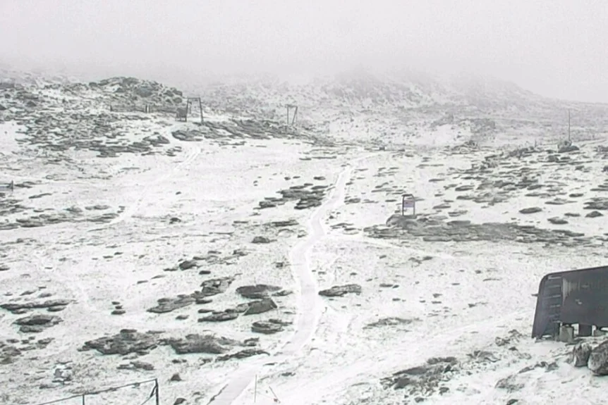
A strong cold front brought snow to Thredbo and the NSW Alps, while Sydney suburbs fell from around 30C to the mid-teens in hours.
A late-spring front brings winter conditions
A sharp cold front has delivered an unusual late-spring scene across New South Wales: snow in the alpine region, storms and a rapid plunge from near 30C to the mid-teens around Sydney. The swing shows how quickly conditions can change when warm air over northern Australia meets the cold Southern Ocean. For people caught between those two air masses, the shift wasn’t gradual: it changed the feel of the day within hours.
David Crock, a senior meteorologist at the Bureau of Meteorology, described November as a “very volatile time of year”. The cold snap itself wasn’t especially unusual, he said, though it remains striking when it arrives. That distinction matters: a weather event can fit within the range of expected conditions and still create a sharp practical disruption, especially when people have planned for warmth. The calendar says late spring; the temperatures offered a different reminder.
Snow fell as low as 400 to 500 metres in parts of Tasmania, while the Australian Alps in Victoria and NSW saw snow down to about 800 metres. Thredbo reached -5C overnight; temperatures were at 0C on Sunday morning as snow continued to fall. The difference in snow levels across the regions reflects how conditions varied across the front, rather than a single uniform band of cold. At those elevations, a cold snap can turn an ordinary weekend outdoors into a winter outing.
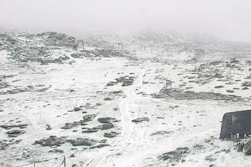
Thredbo dropped to -5.0 degrees Celsius overnight. (Supplied)
A dramatic turn across Sydney
The temperature drop was just as striking in the city’s west. Sydney reached 29.7C shortly after lunchtime on Saturday, then fell to 14C by evening. Penrith went from 31.5C at 3pm to 14C later that night, while Parramatta dropped from 30.4C to 13C. These readings make the front’s progress tangible: the change wasn’t confined to the mountains, and it didn’t wait until the following day to be felt.
For anyone planning around the forecast, the local timing is the point. A warm afternoon can encourage people to dress for summer, while a rapid evening fall calls for a different choice. The numbers here are striking because they describe one day’s reversal, not a slow seasonal cooling. Sydney’s change also puts the alpine snow in context: the same front produced very different conditions across the state.
The front also brought heavy rain and storms. Crock said the strong temperature gradient between hot conditions in northern Australia and cold water in the south helped drive powerful fronts, pushing cold air through NSW and into southern Queensland. In broad terms, sharp contrasts between warm and cold air can support energetic weather systems; here, the reported result was a fast-moving change that brought both storms and a strong southerly shift. That’s a useful explanation for why the cold arrived alongside unsettled weather, rather than as a quiet drop in temperature.
Snow caught Thredbo by surprise
Madeleine McVie said the snowfall was unexpected after a warm winter, but “beautiful” enough to build a snowman. The flakes began falling around 4pm on Saturday and grew heavy overnight. Her reaction captures the split response such weather can prompt: the snow was a welcome spectacle, but the sudden cold was harder to enjoy once it was time to get outside.
“It certainly was hard to get out of bed. It is very cold down here,” she said. Hikers at Mount Kosciuszko were delighted, though neither they nor locals preparing for the mountain biking season had expected snow in November. The surprise wasn’t simply that snow appeared; it was that it arrived as people were thinking about activities associated with warmer conditions. Plans built around a season can change quickly when the weather refuses to follow the expected script.
And this is the part most people overlook: an event can be both enjoyable and inconvenient, depending on where you are and what you’re doing. For hikers, fresh snow can make a day memorable, while cold, wet conditions make preparation more important. For locals readying for mountain biking, the same weather interrupts the transition to a different kind of season. A striking scene doesn’t tell the whole story of how a front affects people on the ground.
What the change means for the days ahead
Sunday’s temperatures sat between 10C and 12C across much of the state. Strong southerly winds and hazardous coastal conditions were forecast for Monday, with the cold expected to persist. That means the initial temperature drop was only part of the story: wind and coastal conditions were also expected to shape how the weather felt and what activities were sensible.
If you’re working in this space, the episode is a reminder that seasonal labels can be poor guides to short-term conditions. November may usually point people toward warmer weather, but Crock’s description of the month as volatile helps explain why a late cold snap can still occur. This is more significant than it looks: the contrast between a warm afternoon and a cold evening turns a broad forecast into a practical question about timing, clothing and plans.
The broader takeaway is modest but useful. The front’s effects ranged from snow in the alpine areas to storms and a steep temperature fall around Sydney, with strong winds and hazardous coastal conditions also in the forecast. Those details show why one headline temperature can’t capture the experience across a large region. And yet, the event doesn’t need to be exceptional to catch people off guard. A fast change, at the wrong time of day or in the wrong place, is enough.
Discussion
Sign in to join the discussion.